Of all the places in London where people have walked, watched and written, few areas have been so explored as the East End of London. Chaucer is reported to have lived in the actual old Aldgate, and Stowe had explored the eastern fringes of the City. Later, writers like Charles Dickens, Jack London, Arthur Morrison and Israel Zangwill used their literary skills to bring the rookeries, hostels and tenements to life. We also see social scientists such as Charles Booth, Henry Mayhew, Beatrice Webb and Clara Collet casting their more empirical eye over streets in which they saw poverty, destitution and misery. In recent years the likes of Monica Ali and Rachel Lichtenstein have found inspiration in the area and have added to the canon of work.
For my walk, I decided to concentrate on the Jewish experience in the East End and to specifically look for the traces of one man, Israel Janes, my wife’s great grandfather. Israel was one of the many Russian Jew’s who had left their homeland due to the Pogroms in the 1880’s and somehow found his way to Whitechapel. By studying census and electoral roll information I knew he lived in the area from at least 1901 right up till just before the second world war. So, armed with a copy of the 1900 Jewish East London map I headed East to try and find if anything remains of the rich Jewish heritage he would have known.

Beginning my walk at the top of Stepney Green, I search for the house where the 1911 census reveals that the Janes family were living. Number 15 still stands within a terrace of houses and although they have the appearance of nineteenth century artisans housing, all doors and windows have been replaced with modern counterparts, the London stock brickwork scrubbed clean, as if in an attempt to clean the past.

Walking further down Stepney Green, I see a beautiful row of Georgian houses, now being sold for millions of pounds. Number 37 was once a ‘Home for aged Jews’ and The Rosalind Green Hall was once a synagogue. In sharp contrast to the Georgian splendour, though still architecturally attractive, stand the tenement blocks built by the 4% Industrial Dwellings Society, once home to many Jewish families.


Through a gap I see Temple Court, now flats, but once the former East London Synagogue. Near the bottom end of the green stands the neglected Leonard Montefiore drinking fountain. In some ways this stands as a symbol of the decline of the Jewish diaspora in the area, once confident and proud, now largely forgotten.

Not confident that I am going to find much, I retrace my steps into Whitechapel Road and walk westwards towards the towers of the city. A sign catches my eye, directing me through an arch in a 1960’s council block. In a small square I am pleased to see Rinkoff’s bakery, one of the surviving Jewish bakery’s in the area. This was just one family of Jewish bakers amongst the Levy’s, Kossofs and Grodsinskis. Founded in 1911, albeit in a different location, it may have been known to the Janes, who may have even bought their challah breads and beigel’s from them. (note: this is the East End, definitely “Beigel’s” not “Bagels!”)

Taking a left turn behind the Royal London Hospital, I search for Varden Street where Israel was noted on Electoral Rolls in the 1930’s. Many of the buildings here appear to be post second world war and a check on Bombsight, and in the LCC Bomb damage maps, confirm major bomb damage during the blitz. A slight detour takes me into Nelson Street to see one of the few surviving Synagogues in an area which once boasted over two hundred.

Crossing Commercial Road I find Langdale Street, where Israel Janes lived in1901 when the census was taken, but like Varden Street this no longer contains any of the buildings he would have recognised. He no doubt would have known nearby Hessel Street with its thriving market. The Russell and Lewis map shows this was an area with a large Jewish population. If one wants to get a flavour of what this area might have been like, a 1962 film, The Vanishing Street, gives a tantalising view of how it might have once looked. I ponder that perhaps as historians we should sometimes adopt a more interdisciplinary approach and use film and oral sources to rediscover the past? In streets, now quiet apart from traffic noise, you once would have heard Yiddish being spoken or perhaps the latest song from the Yiddish music hall , it is far too easy to forget that these thoroughfares were living streets full of smells, people and song.
![jewish_east_end_map_Whiter[1]](https://wtlh18.files.wordpress.com/2018/11/jewish_east_end_map_whiter1-e1543676041484.jpg?w=604)
 Returning back to Whitechapel High Street, I finish my walk at Aldgate East Station, next to the old Library, once called the University of the Ghetto as its reading rooms were once used by poets and writers like Bernard Kops and Issac Rosenberg. Now part of the Whitechapel Gallery it seems like a fitting place to end my walk.
![What-To-See-In-Whitechapel-London_-5[1]](https://wtlh18.files.wordpress.com/2018/12/what-to-see-in-whitechapel-london_-51.jpg?w=604)

All photographs authors own unless otherwise credited.
Bibliography
Lach, Vivi, Whitechapel Noise: Jewish Immigrant Life in Yiddish Song and Verse, London 1884-1914. (Detroit, Wayne University Press, 2018)
Fishman, William J, East End 1888, (London, Gerald Duckworth & Co, 1988)
White, Jerry, Rothschild Buildings: Life in an East End Tenement Block 1887-1920 (London, Pimlico, 2003)
Palmer, Alan, The East End: Four Centuries of London Life (London, John Murray Ltd, 1989
Stedman Jones, Gareth, Outcast London: A study in the relationship between classes in Victorian Society, London, Verso, 2013)
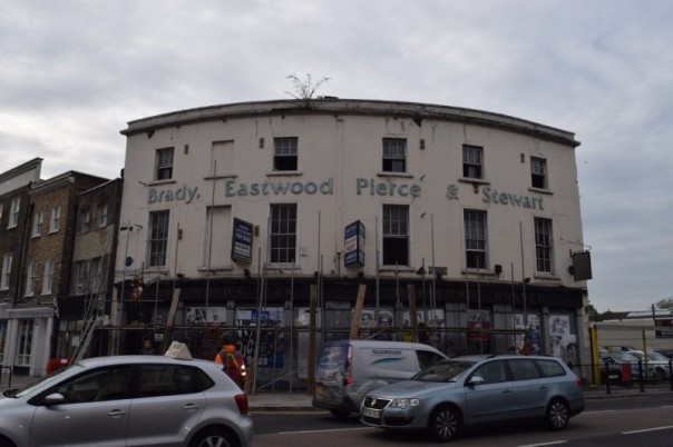
 5. While many campaigners have seen pubs as the root of all working-class evil, it is easy to forget that they often had other roles in the community. The Noah’s Ark, like many other Deptford pubs, was often used as a public meeting place for less enjoyable and more serious matters; coroners’ inquests were held, and political groups would also sometimes meet. A report of in the
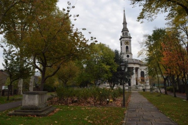
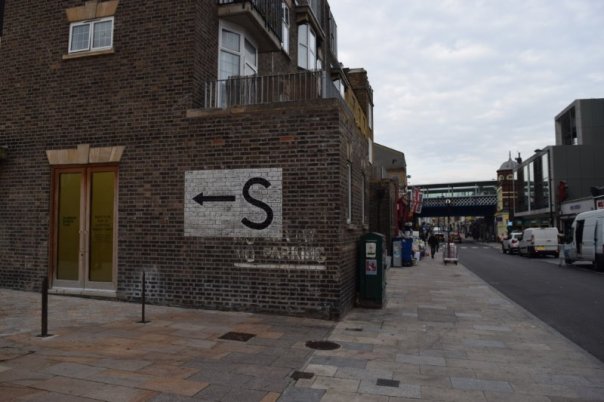
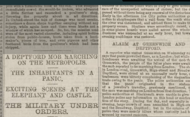
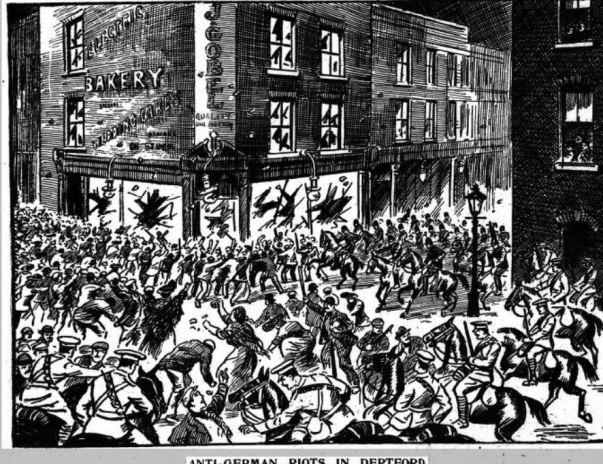 Illustration from
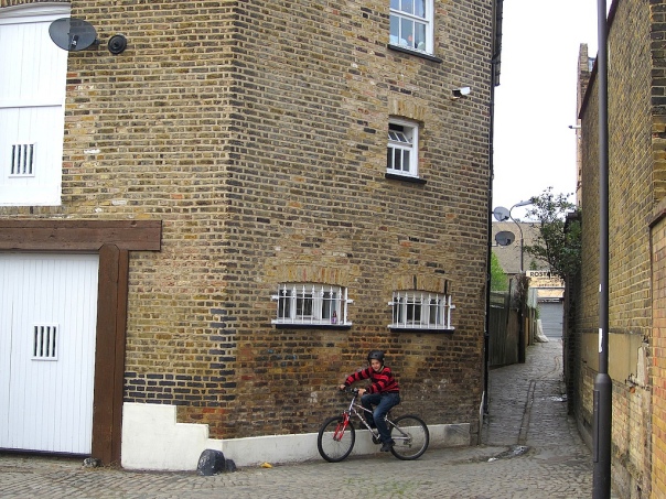
